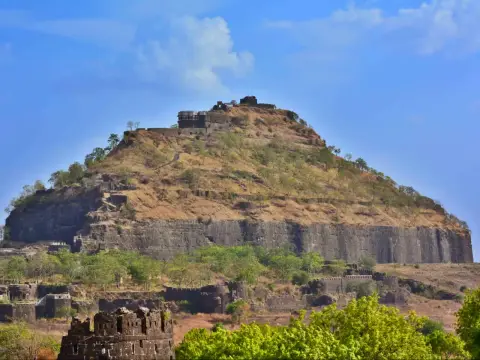
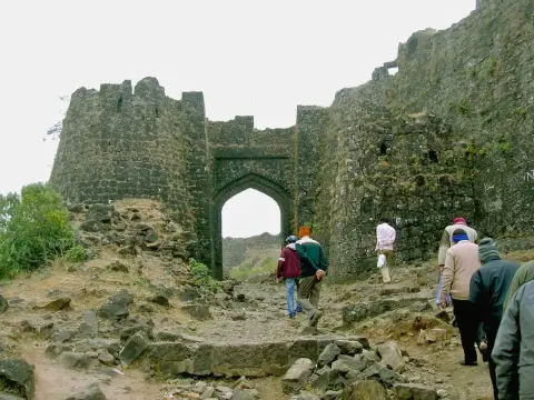
Harishchandragad is the trek I’d call the most complete in Maharashtra: an ancient temple, a cave shrine in cold water, a summit peak, and Konkan Kada, a cliff that curves out over the valley like a cobra’s hood. It’s a big day, or better, a night under the stars on the plateau. Pick your route carefully. Pachnai is the easy way up; Nalichi Vaat is for climbers only.
Why Harishchandragad matters
The carvings at the Harishchandreshwar temple, in the Kedareshwar cave and at the Nageshwar temple in Khireshwar village point to a medieval fort with roots in the Shaiva, Shakta and Nath traditions. The Mughals held it later, and the Marathas took it in 1747. Most people come for the temples and the cliff more than for the fort itself, and they’re right to.
Pick your route
| Route | Start | One way | Time up | What it’s like |
|---|---|---|---|---|
| Pachnai | Pachnai village | About 3 km | 2 to 3 hours | The easiest and shortest; a short rock patch, then a straight path to the temple |
| Khireshwar (Tolar Khind) | Khireshwar village | About 6 to 7 km | Longer than Pachnai | The most popular; longer and more scenic |
| Nalichi Vaat | Belpada village | About 8 to 10 km | 7 to 9 hours | A technical gully at up to about 80 degrees; experienced trekkers with a guide only |
My advice: if it’s your first time, go up by Pachnai or Khireshwar. Don’t attempt Nalichi Vaat without someone who has done it before, and never in the rains.
What to see on Harishchandragad
- Harishchandreshwar temple. The ancient stone temple at the heart of the plateau, carved out of the rock.
- Saptatirtha Pushkarni. A rock-cut water tank with temple-like structures around it, next to the temple.
- Kedareshwar cave. A cave shrine with a Shiva linga about 5 feet high standing in ice-cold water. You can’t enter it in the monsoon.
- Taramati peak. The highest point, about 1,431 m. On a clear day you can see across to the Naneghat plateau.
- Konkan Kada. The overhanging cliff on the western edge. Time your arrival for 30 to 45 minutes before sunset. Stay well back from the edge: there is no railing.
How to reach the start
- Pachnai: the usual base for the easy route, reached by road from the Kalsubai and Bhandardara side.
- Khireshwar: near Malshej Ghat, on the Junnar side.
- From Pune or Mumbai: it’s a long drive either way. Most groups travel overnight and start climbing before dawn.
My tips
- Start before dawn if you’re doing it in a day.
- Carry your own water. Water sources on the routes are unreliable.
- Camp on the plateau if you can; sunset at Konkan Kada and sunrise on Taramati are the reasons to stay.
- Expect no phone signal. Tell someone your plan.
- In the monsoon: leeches, slippery rock and no entry to the Kedareshwar cave. Stick to Pachnai or Khireshwar.
Places near Harishchandragad
- The Kedareshwar cave is also in my list of cave treks in Maharashtra.
- Naneghat, the ancient pass with a Satavahana cave inscription.
- Shivneri Fort and the Junnar caves, on the Pune side.