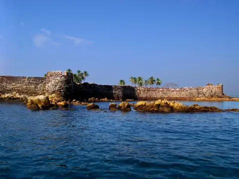
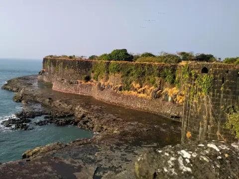
Vijaydurg, on the Devgad coast of Sindhudurg district, was the chief base of the Maratha navy and is one of the 12 UNESCO World Heritage forts of the Maratha Military Landscapes. Three lines of walls and 27 bastions guard a headland at the mouth of the Waghotan creek, with the sea on three sides. It is open in daylight, takes 2 to 3 hours to see, and is best from November to March.
Why Vijaydurg matters
The headland was a fort long before the Marathas. It was known as Gheria, and traditions credit the first fortification to the Shilahara king Bhoja II around 1200. It later belonged to the Adil Shahi sultans of Bijapur.
Chhatrapati Shivaji Maharaj took it in the 1650s. He wrapped it in a triple line of walls with tall bastions and renamed it Vijaydurg, the “fort of victory”. The Waghotan creek behind it was deep and sheltered, so it became a harbour and a shipyard for the Maratha fleet.
Its greatest days came under Kanhoji Angre, the Maratha admiral who made it his headquarters from 1698. The East India Company and the Portuguese attacked it again and again in the 1710s and 1720s and failed each time. It earned the name “Gibraltar of the East”. In 1756 a combined British and Peshwa force finally took it from Tulaji Angre. The Peshwas held it until it was given up to the British in 1818.
In July 2025 UNESCO inscribed Vijaydurg as one of the 12 forts of the “Maratha Military Landscapes of India”. It is the only one classed as a coastal fort.
How to reach Vijaydurg
Vijaydurg village is at the end of the road on the north bank of the Waghotan creek, about 30 km from Devgad.
- By train: the nearest Konkan Railway stations are Rajapur Road and Kankavli, each roughly 60 to 80 km away. Take an MSRTC bus or a taxi on to Vijaydurg.
- From Pune: about 455 km, 9 to 10 hours.
- From Mumbai: about 485 km, 10 to 11 hours by road, or take the train to Rajapur Road.
- By air: Sindhudurg (Chipi) airport is the closest, then Goa.
The fort is joined to the land on its east side, so you simply walk in from the village. No boat is needed.
What to see on Vijaydurg
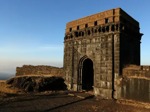
- The gates: you enter through Hanuman Darwaja and on to the great Yashwant Mahadarwaja, a hidden, angled (gomukhi) gate that could not be fired on directly from outside.
- The triple walls and 27 bastions: walk between the lines of walls and along the ramparts. Some bastions are two storeys high. The western walls take the full force of the sea.
- The Khalbatkhana: a hall for important meetings, one of the few such buildings on any Maratha fort.
- Cannons and cannonballs scattered around the fort.
- The raised platform known locally as the place where the British astronomer Norman Lockyer set up to watch the total solar eclipse of January 1898. You will often hear that helium was discovered here; it wasn’t. The helium story began with the 1868 eclipse, observed elsewhere in India, and was worked out by Lockyer in England.
- The view over the creek, the fishing harbour and the open sea.
The undersea wall. In the 1990s, divers from India’s National Institute of Oceanography found a stone structure on the seaward side of the fort, at 8 to 10 m depth: about 122 m long, 7 m wide and 3 m high. It may have been a barrier to wreck enemy ships, or a breakwater; some researchers think it could be natural. You can’t see it, but it is a good story to stand above.
The Maratha dock. About 1.5 km up the Waghotan creek are the remains of a dock cut into the rock, where Maratha warships were built and repaired.
Tips for your visit
- Hire a local guide at the gate. Vijaydurg’s stories are what bring the walls to life.
- Go early or late. The fort has little shade and the stone gets hot.
- Stay a night. There are homestays in Vijaydurg and many more in Devgad. Fresh fish thali is the order of the day.
- Mango season (April and May) is hot, but Devgad’s Alphonso mangoes are famous.
Places near Vijaydurg
Devgad (fort, beach and the lighthouse), Kunkeshwar temple on the beach, and further south Malvan for Sindhudurg fort, Tarkarli and Devbag. To the north, Ratnagiri and Jaigad are on the way back towards Mumbai.